Interactive map showing predictions of blue sharks' (Prionace glauca) foraging hotspots
Marine Protected Areas
(Might take a while to toggle)
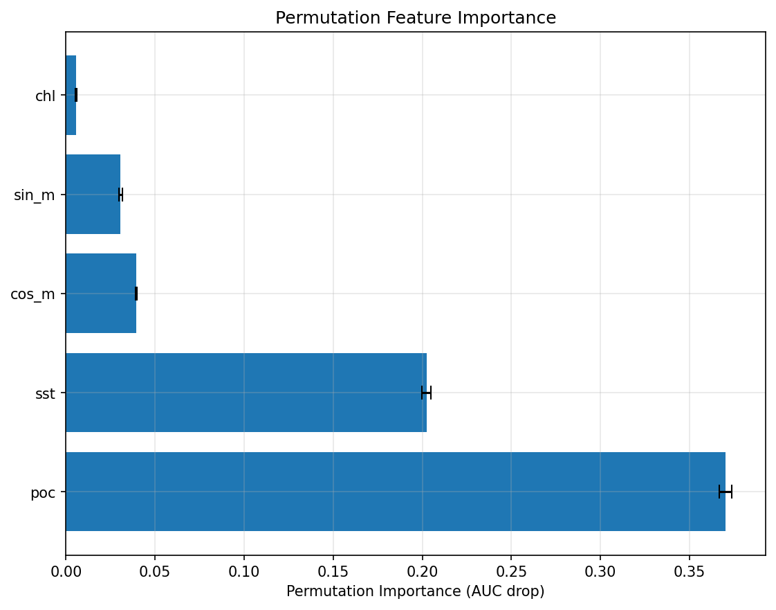
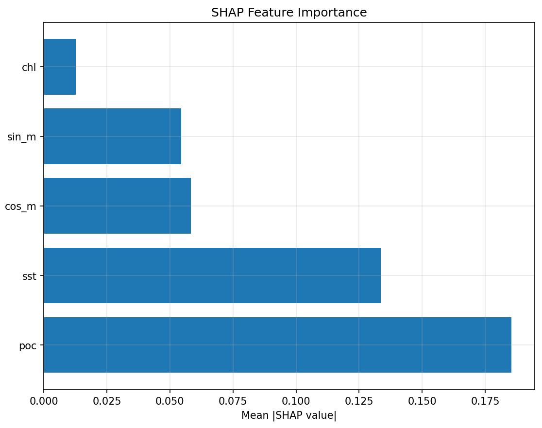
Oceanographic drivers of shark foraging
What makes sharks hunt where they do? We use machine learning to identify which ocean conditions best predict shark feeding behavior.
📊 The Rankings (most important first):
1. POC (Particulate Organic Carbon) - #1 predictor! Shows where food is abundant
2. SST (Sea Surface Temperature) - Affects prey distribution and shark metabolism
3. Seasonality (cos_m & sin_m) - Time of year matters for migration patterns
4. Chl (Chlorophyll) - Indicates plankton blooms that start the food chain
🎯 Why this matters: By understanding these "drivers," we can predict where sharks will feed even in areas we've never tracked them before!
Marine Protected Areas (MPAs)
Ocean "national parks"! MPAs are designated zones where human activities like fishing and development are restricted or prohibited to protect marine life and ecosystems.
🌍 Global Goal: Countries worldwide aim to protect 30% of the ocean by 2030 (called the "30×30" target). We're using shark tracking data to help design these protected areas more effectively!
🦈 The Problem: Many shark feeding hotspots we predicted fall OUTSIDE existing MPAs. This means we need to update protection boundaries to follow where sharks actually go, not just where we think they should be.
💡 Smart Protection: Our data helps governments create MPAs that move with the sharks and protect the areas they truly need for survival.
🔍 Learn More: Click on a random MPA on our map to see more details about it!
Note: Having the MPA layer might slow down the map's performance, especially on older devices.